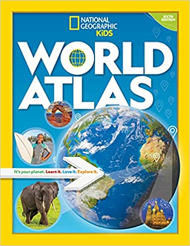
When opening up an atlas you expect maps like you do here in the sixth edition of National Geographic Kids World Atlas—Both a physical and political color coded map for seven regions. More than 120 total.
But what makes this rise above all the rest are the extras. Here are my top five:
- The the 200 plus photographs bring you closer to what makes each country unique. They are both colorful and memorable.
- Before the maps sections begin there are 55 pages of background information on Understanding Maps, Planet Earth, and details on features that effect the physical and political world. Great stuff. It’s like a separate book!
- Each region has a handy basic list of stats. No need to go searching for this often sought after information.
- A Back of the Book feature adds even more value. Images of each countries flag, a glossary, and loads of Geo facts and Figures. A perfect topping to the journey you’ve taken.
- The 20 page index. A quick way to find what you need. Easy to use and includes even the most obscure places on Earth. Need info on Taldyqorghan, Kazakhstan? No problem: Page 115 and there use the cross reference ‘C6’ to find it on the map.
What makes this a great purchase for any middle grade student is National Geographic Kids World Atlas will get used over and over. The price is also a bargain: less than $20 for the hardback or under $15 for the lighter paperback version.
Bring the world a little closer with this beautifully laid out volume.


I just love the NatGeoKids books. Every one is a treat. Thanks for the heads up on this one.